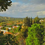
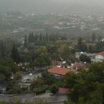
Η Ευρύχου, ένα γραφικό χωριό της επαρχίας Λευκωσίας, αγροτικό κέντρο της Σολιάς, βρίσκεται 50 περίπου χμ. νοτιοδυτικά της Λευκωσίας και 30 χμ. από το Τρόοδος. Βρίσκεται πάνω στον παλαιό δρόμο Λευκωσίας – Τροόδους.
Λόγω ακριβώς αυτής της θέσης της, οι κλιματολογικές και γενικά οι καιρικές συνθήκες της είναι πολύ καλές, μεσογειακές. Εδώ δεν υπάρχει ούτε το ψύχος του Τροόδους, αλλά ούτε και η υπερβολική ζέστη της Λευκωσίας, ούτε ακόμη και η υγρασία της θάλασσας.
Η Ευρύχου είναι κτισμένη στην ανατολική όχθη του ποταμού Καρκώτη, σε μέσο υψόμετρο 440 μέτρων. Από τις πλαγιές ρέουν μικρά ρυάκια προς την κοιλάδα, τα οποία και διαμελίζουν το τοπίο του χωριού.
Το χωριό δέχεται μια μέση ετήσια βροχόπτωση γύρω στα 419 χιλιοστόμετρα, και στη περιοχή του καλλιεργούνται οπωροφόρα δέντρα (κυρίως μηλιές, αχλαδιές, δαμασκηνιές, βερυκοκκιές και ροδακινιές), λίγα εσπεριδοειδή, αμυγδαλιές, ελιές, λαχανικά (κυρίως πατάτες), λίγα όσπρια, αμπέλια (οινοποιήσιμες ποικιλίες) και σιτηρά (κυρίως κριθάρι). Αν και ολόκληρη η περιφέρεια της Σολιάς είναι φημισμένη για τα φρούτα και τα λαχανικά της, ωστόσο η Ευρύχου είναι ιδιαίτερα γνωστή για την ποιότητα των μήλων της.
Κατά μήκος των πλαγιών της κοιλάδας του Καρκώτη φυτρώνει ποικίλη φυσική βλάστηση, κυρίως ξυσταρκές, τρεμιθιές, κόνιζοι και σκόρπια πεύκα.
Ο πληθυσμός της Ευρύχου σημείωσε μια σταθερή αύξηση από το 1881 που υπάρχουν επίσημες καταγραφές μέχρι το 1946. Το 1881 ήταν το μεγαλύτερο σε πληθυσμό χωριό της Σολέας και το ένατο σ’ ολόκληρη την επαρχία Λευκωσίας με 588 κατοίκους. Το 1891 οι κάτοικοι αυξήθηκαν στους 615, το 1901 στους 634, το 1911 στους 703, το 1921 στους 895, το 1931 στους 950 και το 1946 στους 993. Στις δύο επόμενες απογραφές σημειώθηκε πληθυσμιακή μείωση: 950 κάτοικοι το 1960 και 892 κάτοικοι το 1973. Μετά την τουρκική εισβολή του 1974 η Ευρύχου δέχτηκε προσωρινά ένα πολύ μεγάλο αριθμό Ελληνοκυπρίων εκτοπισμένων, κυρίως από την πεδιάδα της Μόρφου. Έτσι το 1976 ο πληθυσμός ήταν αυξημένος στους 1340 κατοίκους. Κατά την απογραφή του 1982 η Ευρύχου είχε 977 κατοίκους και ήταν το δεύτερο μεγαλύτερο σε πληθυσμό χωριό της Σολιάς, μετά την Κακοπετριά. Στην απογραφή του 2001 Ευρύχου αριθμούσε 819 κατοίκους. Η πληθυσμιακή ανάπτυξη του χωριού οφείλεται κατά κύριο λόγο στην πλούσια και εύφορη γη του. Εξάλλου το μεταλλείο της Σκουριώτισσας, σε μικρή απόσταση στα βόρεια του χωριού, βοήθησε πριν από την εισβολή, στην εργοδότηση αρκετού πληθυσμού. Σήμερα ένας σημαντικός αριθμός των κατοίκων διακινείται στη Λευκωσία για εργοδότηση.
Στα παλιά χρόνια και πριν από την ανεξαρτησία, τόσο οι δρόμοι όσο και γενικά η εικόνα που παρουσίαζε το χωριό, δεν είχε καμία ιδιαιτερότητα για να ξεχωρίζει σαν ένα αναπτυγμένο χωριό.
Εκτός από τους δρόμους που συνδέουν το χωριό με την πόλη και τα γειτονικά χωριά, που κι αυτοί είχαν τα χάλια τους, όλοι οι άλλοι μέσα στο χωριό, στενά μονοπάτια ικανοποιούσαν τις ανάγκες της εποχής που κυριαρχούσαν τα τετράποδα.
Ο φωτισμός στους δρόμους υποτυπώδης-φανάρια πετρελαίου κι αυτά πολύ λίγα. Το ίδιο και η υδατοπρομήθεια του χωριού. Παίρναμε νερό από τα πηγάδια – λάκκους. Οι πιο πολλοί έτρεχαν στις γειτονιές για νερό και μόνο το 1937 είχε προμηθευτεί το χωριό πόσιμο νερό με την εγκατάσταση σε διάφορα μέρη “φουντάνων” από όπου έπαιρναν νερό.
Με την εγκαθίδρυση του Συμβουλίου Βελτιώσεως το 1964, σαν ένας θεσμός τοπικής αυτοδιοίκησης άρχισε μια σταδιακή ανάπτυξη του χωριού. Τα μονοπάτια έγιναν δρόμοι. Τα φανάρια αντικαταστάθηκαν με ηλεκτροφώτιση, πρώτα στους δρόμους και αργότερα σ’ όλα τα σπίτια. Η προμήθεια νερού μπήκε σε όλα τα νοικοκυριά. Εγκατάσταση τηλεφώνων και άλλων τηλεπικοινωνιακών μέσων είναι σχεδόν γενική. Η φυσιογνωμία του χωριού άλλαξε ριζικά και δικαιωματικά μπορούμε να μιλούμε για ένα αναπτυγμένο χωριό. Όσα όμως κι αν έγιναν οι απαιτήσεις για πιο πολλά έργα αυξάνουν και δεν δικαιούμαστε να ξεκόβουμε από τις απαιτήσεις των καιρών.
 Η Ευρύχου, που βρίσκεται σχεδόν στο κέντρο της κοιλάδας του Καρκώτη, αποτελεί το αγροτικό κέντρο της Σολιάς με πολλές υπηρεσίες που εξυπηρετούν ολόκληρη την περιφέρεια.
Διαθέτει Περιφερειακό Δημοτικό Σχολείο, Γυμνάσιο, Λύκειο, Πυροσβεστικό Σταθμό, Υγειονομικό Κέντρο, Αστυνομικό Σταθμό, Υπηρεσία Θύρας, Επαρχιακό Γεωργικό Γραφείο. Επίσης στο χωριό έχει, μετά την τουρκική εισβολή του 1974, την προσωρινή του έδρα ο Μητροπολίτης Μόρφου. Η Μητρόπολη Μόρφου μεταφέρθηκε στην Ευρύχου και στεγάζεται στο κτίριο του Παλιού Δημοτικού σχολείου αφού ανακαινίσθηκε και προστέθηκαν νέα διαμερίσματα. Από πολύ παλιά λειτουργούσε περιφερειακό κτηματολόγιο και δικαστήριο τα οποία λειτουργούν και τώρα.
Εδώ είναι και το Γραφείο Ευημερίας. Στεγάζονται επίσης και τα γραφεία της Επαρχιακής Διοίκησης Λευκωσίας μαζί με όλες τις υπηρεσίες που προσφέρει. Καθώς επίσης και η Αστυνομική Διεύθυνση Μόρφου.
Η Ευρύχου συνδέεται οδικά στα βορειοδυτικά με την Κάτω Φλάσου (περί τα 3 χμ.), στα νοτιοδυτικά με την Τεμβριά (περί τα 2χμ), και στα δυτικά με την Κοράκου (περί τα 2 χμ.). ο δρόμος Λευκωσίας – Τροόδους συνδέει το χωριό τόσο με την πρωτεύουσα, όσο και με τα ορεινά θέρετρα του Τροόδους.
Ο οικισμός της Ευρύχου είναι κτισμένος στο σύνολο του κατά μήκος της κοιλάδας του Καρκώτη και ιδιαίτερα κατά μήκος του παλαιού δρόμου Λευκωσίας Τροόδους. Πρόσφατα άρχισαν να κτίζονται καινούργιες οικοδομές στις πλαγιές της κοιλάδας. Παρόλα αυτά, το χωριό διατηρεί σε μεγάλο βαθμό τη λαϊκή αρχιτεκτονική του. Οι κεραμιδένιες επικλινείς στέγες, τα ξύλινα μπαλκόνια, τα μαντάλια και τα ρομανίσια, και το τοπικό πέτρωμα με το οποίο είναι κτισμένο οι τοίχοι των σπιτιών είναι πληθωρικά στοιχεία της λαϊκής αρχιτεκτονικής του χωριού.
Οι δυο εκκλησίες Ευρύχου, του Αγίου Γεωργίου και της Αγίας Μαρίνας, είναι του περασμένου αιώνα. Άλλη εκκλησία είναι εκείνη της Αγίας Κάρας. Περί το ένα χμ. βόρεια του χωριού, βρίσκεται άλλη εκκλησία αφιερωμένη στον Άγιο Κυριάκο, η οποία θεωρείται χαρακτηριστικά μεσαιωνικού τύπου.
Ο A . Gaudry , στο βιβλίο του Recherches Scientique en Orient , αναφέρει ότι η Ευρύχου παρήγε, στα μέσα του 19 ου αιώνα, το καλύτερο βαμβάκι της Κύπρου. Το χωριό απέκτησε μεγαλύτερη σπουδαιότητα μετά την αγγλική κατοχή της Κύπρου, εξαιτίας έργων υποδομής που έγιναν. Έτσι, το 1899 συμπληρώθηκε η κατασκευή του δρόμου που κατέληγε στο χωριό από τη Λευκωσία. Σαν κεφαλοχώρι της περιοχής, η Ευρύχου απέκτησε Αστυνομικό Σταθμό από το 1905 και απετέλεσε το δυτικό τέρμα του Κυπριακού Σιδηροδρόμου που ένωνε την Αμμόχωστο με τη Λευκωσία και τη Λευκωσία με την Ευρύχου, με γραμμή συνολικής αποστάσεως 72 μιλίων. Ο Σιδηρόδρομος, αν και λειτούργησε από το 1906, με την Ευρύχου ενώθηκε τον Ιούνη του 1915. Το 1932 λειτούργησε και σιδηροδρομική διακλάδωση μεταξύ Ευρύχου και Καλού Χωριού Λεύκας.
Για την ονομασία του χωριού υπάρχουν διάφορες εκδοχές. Η επικρατέστερη εκδοχή αναφέρει ότι πήρε την ονομασία του το χωριό λόγω του ότι είναι το μοναδικό χωριό της περιοχής που έχει την μεγαλύτερη έκταση. Ευρύς Χους που στα αρχαία ελληνικά σημαίνει Μεγάλος χώρος. Μια δεύτερη εκδοχή αναφέρει ότι σύμφωνα με την παράδοση το όνομα δόθηκε στο χωριό από μετανάστες άλλων περιοχών οι οποίοι βρήκαν εδώ αρκετή και εύφορη γη Ευ Χους. Μια άλλη εκδοχή αναφέρει ότι πήρε το όνομα του από τον πρώτο κάτοικο της κοινότητας που ονομαζόταν Ευρύχιος.
Σε παλιούς χάρτες του 1573 το χωριό αναφέρεται και με την ονομασία Εαρικό και ο Μας Λατρί το γράφει Eurichou.
